We were up early ( I think this meant 5am) for breakfast and a start to a long day of travel. After munching my eggs I was standing in the street watching Cusco go by when a strange bus appeared reversing down the street. (The reversing bit always happened: it seemed to be because the street is narrow outside the Hotel so the bus can't stop there and it is one way so they can't come down forwards.) The bus looked different: this is because it was different - we were taking on a new driver who knew the roads we were about to embark on, and a more powerful bus was to be used.
Another couple of new faces also appeared. As well as an extra guide - Janice - who was required by the Government with a group our size in the Manu Biosphere we scored a co-driver and a little lad wearing a Policia National cap. I assumed he was a cop who wanted a lift somewhere and thus, as in Tanzania he was given a lift. From this starting point I was not surprised when he hopped off the bus a few kilometres down the road. We were told this was a town specialising in baking bread, but I was surprised when the cop reappeared with a big bag of loaves and hopped back on the bus. On asking a couple of questions - possibly a useful way of getting answers - it emerged he was our cook! Appallingly, I never learnt his name. So I shall call him Mandrake after the magician in a cartoon strip: this guy could consistently produce amazing meals for 20 people out of a small esky.
After loading up on bread our first birding stop is a large wetland opposite an archaeological site. We immediately spot a range of ducks and some small reed-dwelling birds. The latter behave just like small reed-dwelling birds in Australia and the US (ie dive into the reeds and lurk there making small noises and rustling the reeds). Eventually they lost the plot and emerged, providing several ticks for the group list and some megaticks for my life list.


 There were a few settlements up here (albeit with next to no trees). At the biggest of these a large market was in position leading the driver to sort out a traffic jam and then drive round the back of the village. This gave us a look at a largeish herd of llamas (at this altitude pronounced 'jamas' rather than 'yamas' - only a newbie would say 'lamas' unless referring to Tibetan priests). I established that there is reticulated electricity to all these places, which must involve astonishing logistics in setting up the lines. Also surprisingly most of the power came from the hydroelectric station where we started our walk on the Inca trail. I indulged myself in a little more cultural imperialism to snap the folk in a truck waiting to go home from the market.
We took lunch close to the high point on the road - in a pine forest for goodness sake - and noticed a few other vehicles on the road. As we set off we got great views of a Caracara, but felt that was about all we would see.
After several more kilometres we got down to a small town beside a river. Yet again a market was happening here. So was a bano, although on a scale of 1 to 10 it was generally rated as for emergency use only! As we got into the bus we found our driver being invited to assist the Policia National with their enquiries. After this discussion had gone on for a while Juan went off to see what the issue was and it turned out there had been a robbery in the area recently so the cops were checking things out a little more than they used to. No biggie.
The Peruvian truck way out of town was to go back up and across an alleged ford. The gringo bus way out of town was across a bridge that seemed to have been blocked off for repairs. My view was that the dodgy bridge was the better option, but I did enjoy Ron's question as to "Why isn't Juan getting back on the bus?" after opening up the barricade! As we started to go up another range in the cordillera Juan pointed out that the River we were on went NE to Colombia and then joined the main Amazon. On the other side of the ridge the rivers all flowed SE to Bolivia before joining the Amazon. {I was interested that the source of the Amazon was near Arequipa, some hundreds of kms south of Lima.}
After grinding our way up the ridge we got to some more pine forest where the big excitement was Andean Flickers. Although woodpeckers we got our best views of them perched on dry sandy ridges above the forest.

An interesting aspect of the agriculture up here was the use of square cross-section furrows. When I asked Juan about this he explained it was more micro-climate adjustment. By keeping the furrows damp it slightly raises the humidity and temperature both of which promote plant growth. The crop is planted on top of the furrows rather than in the trench - presumably it is too soggy down there. I didn't note, and now can't remember, if this is the result of an Inca experiment or something that has been developed more recently.
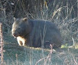
Again we head upwards towards the entrance to the Biosphere. This appeared to be very cloudy - possibly this is why the area is biologically known as cloud forest? It was also 'elfin forest' since the trees were relatively low compared to the giants of the rain forest we are to meet later. several new birds and some nice orchids were met in the gloom of the cloud and the late afternoon as we were at the entrance. The weirdness was the behaviour of some visitors with a 4WD and some dogs which rioted around the place (and the appearance of a couple of guys on mountain bikes - and body armour - who just disappeared into the cloud). {WRT the latter from some folk we spoke to on the flight back home there seems to be quite an industry in going mountain biking in the Andes: t-shirts about 'the most dangerous road in the world' were evident.} The image below could well be titled "Welcome to Manu".

On arrival at the lodge (Acca Lodge) everyone - especially our leaders - got a shock in that the accommodation was shared mini-dorms rather than separate rooms. It seemed that this was what was provided at the place which was a research centre at which we were very privileged to be able to stay. Whatever: by this time we all knew one another well enough to survive the experience. Any discomfort was mitigated by a most excellent meal by Mandrake!
And we had a good nights sleep despite - in my case - being in an upper bunk. So overall the Itinerary was well satisfied.
No comments:
Post a Comment